High Altitude Weather Balloon
Designed, launched, and recovered a high‑altitude weather balloon payload with active telemetry and onboard imaging.
Skills Demonstrated
- Embedded systems integration (ESP32, sensors, GPS, camera).
- Custom PCB design and power regulation for flight hardware.
- Telemetry pipelines and data visualization (LoRa + web app).
Problem & Context
- Goal: launch and recover a payload with active telemetry transmission.
- Context: personal project.
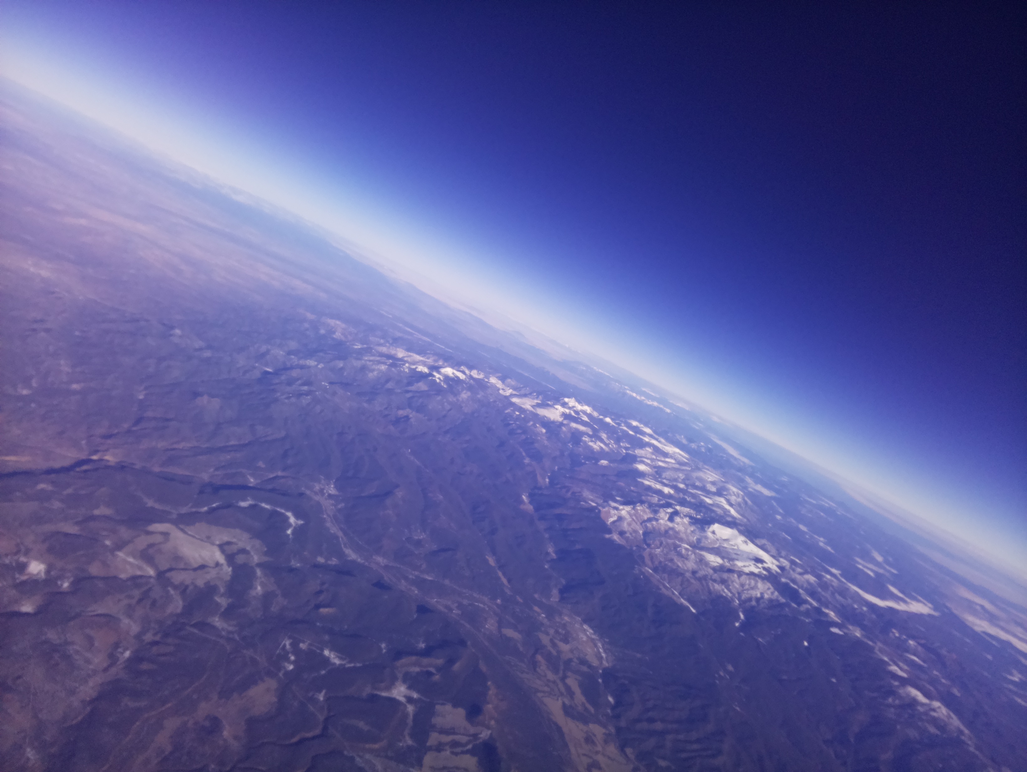
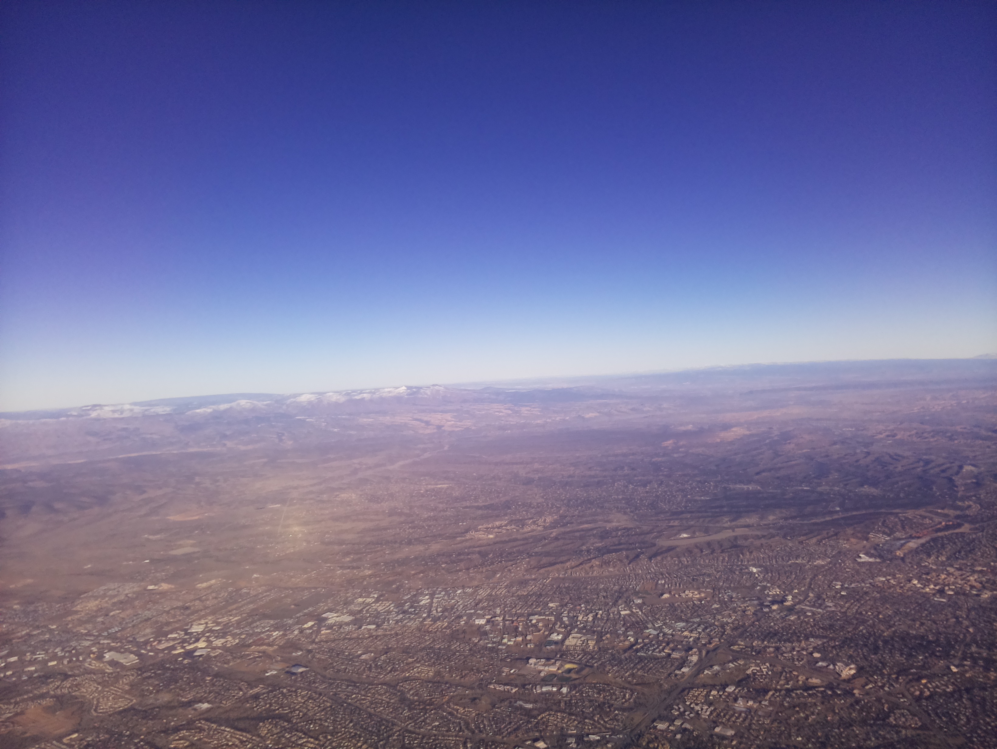
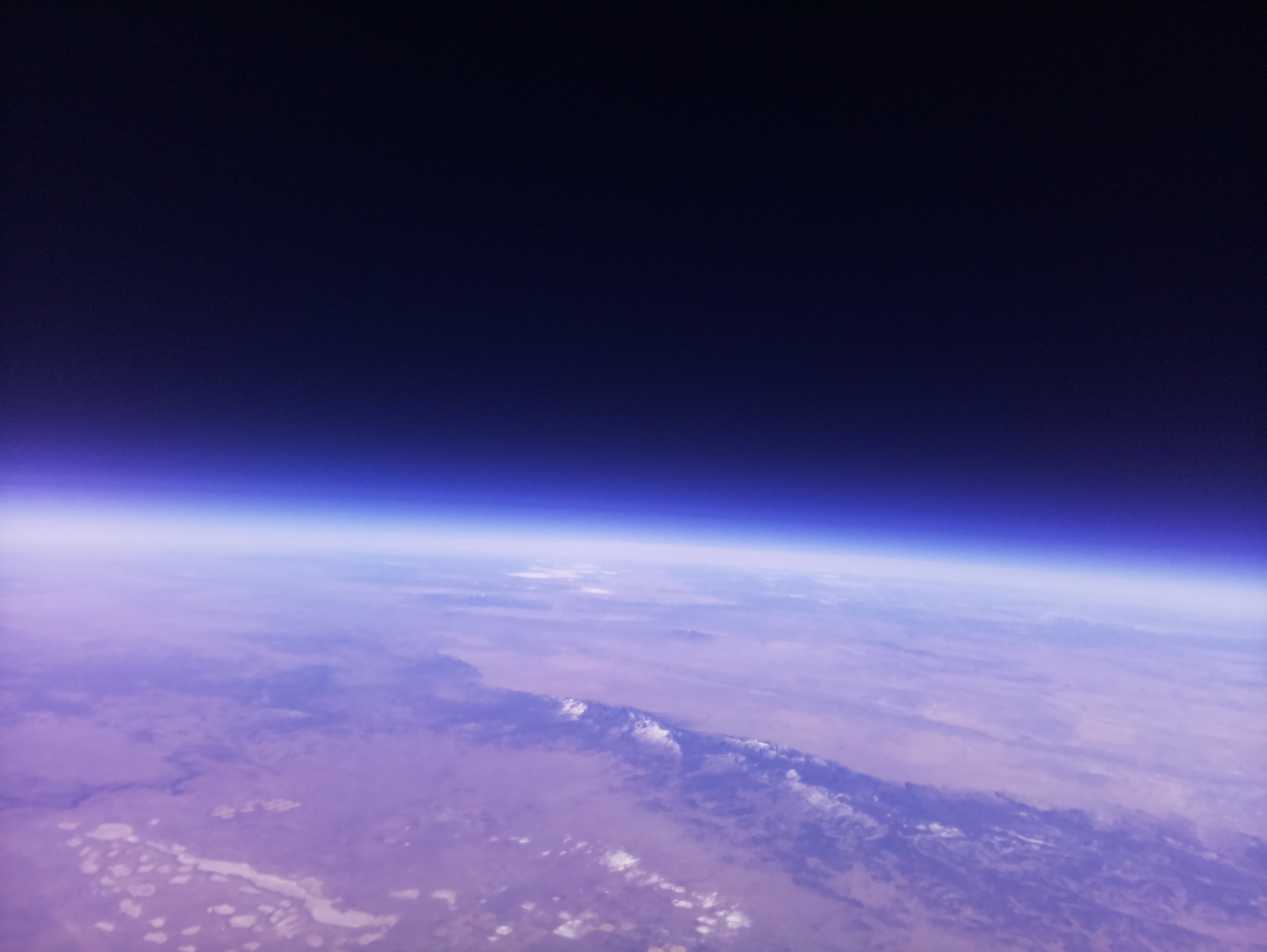
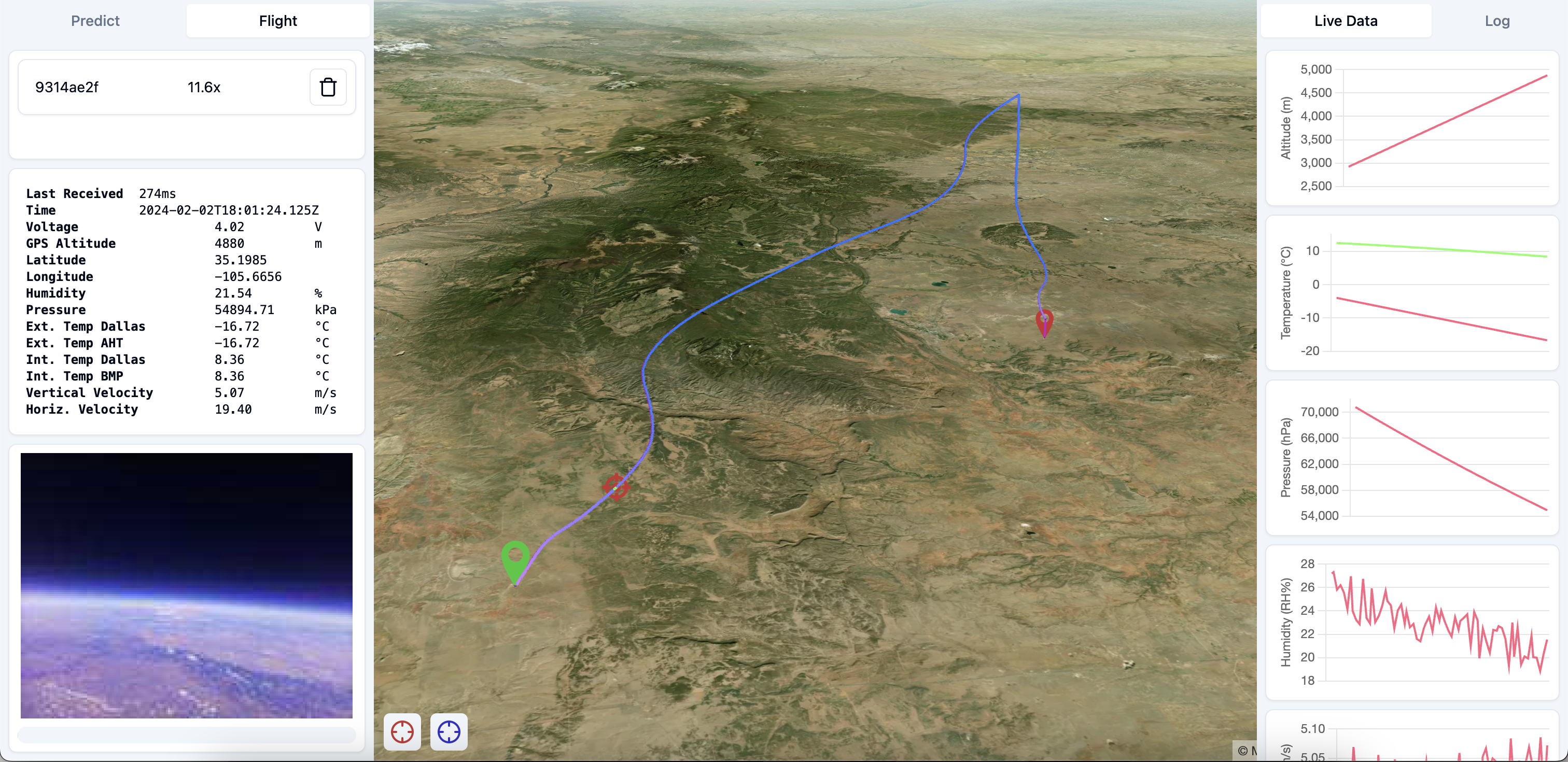
- Outcome: 85‑mile flight to >60,000 ft MSL with recovered payload and imagery.
Process & Constraints
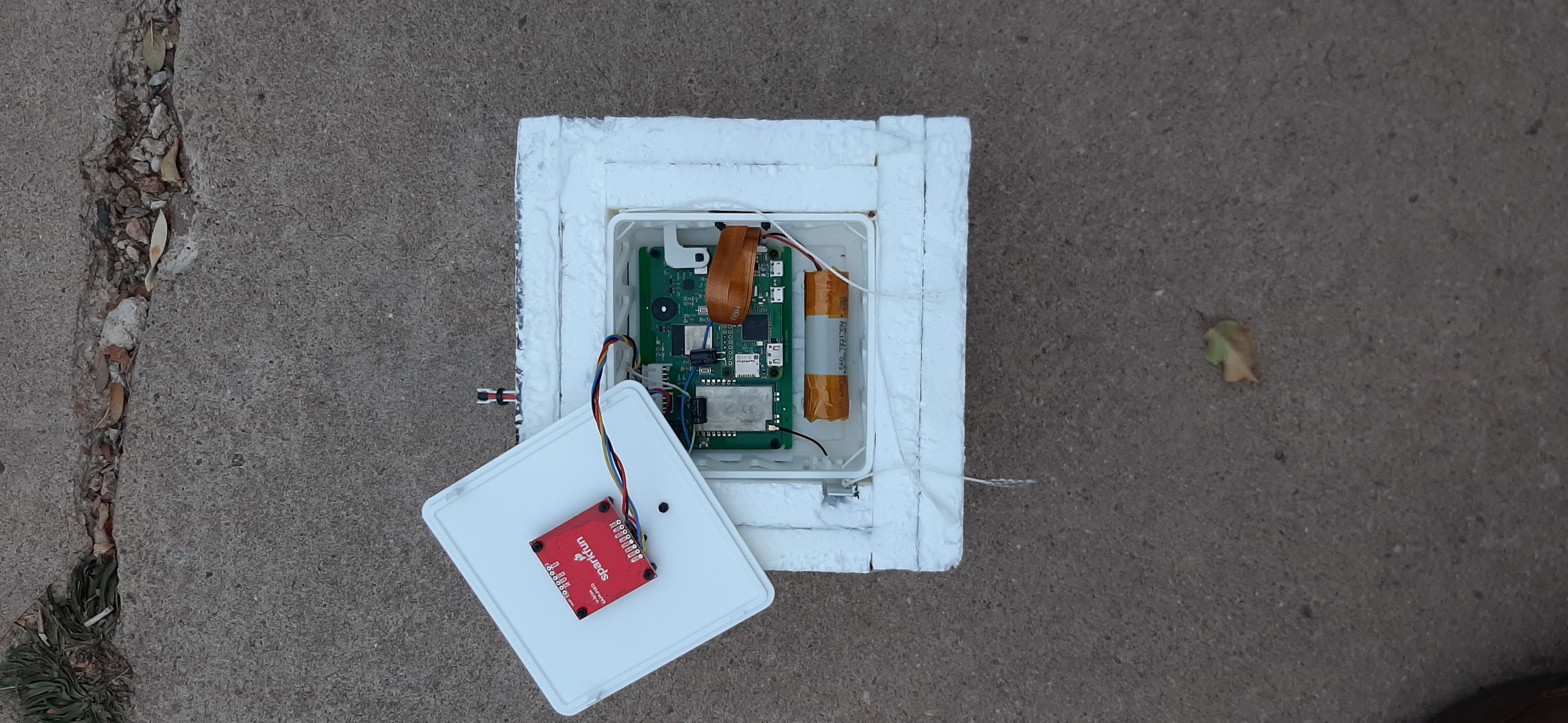
- Payload: Raspberry Pi Camera v2, GPS, sensors, Li‑ion battery, custom PCB.
- PCB: ESP32 microcontroller, LoRa transmitter, temp/battery sensing, regulation.
- Mechanical: 3D‑printed enclosure with insulation for < −50 °C conditions.
- Ground station: React app to simulate and track launches with weather data.
- Live ops: 3D map tracking, sensor plots, and image downlink during flight.
Results & Impact
- Successful end‑to‑end flight with active telemetry and payload recovery.
- Captured high‑resolution images throughout the ascent and descent.
- Demonstrated an end-to-end embedded systems pipeline from PCB design through live data transmission.
Team & Contribution
- Collaborated on payload design and pre-launch testing; independently led PCB integration, telemetry workflow, and ground-station development.
Media